
Knockanaskill [Cnoc na nEascal]
Good walks are even better shared.
Overview
Knockanaskill [Cnoc na nEascal]
Overview
Knockanaskill, affectionately known as Cnoc na nEascal, is a delightful Marilyn located in the magnificent Scottish Highlands. At an elevation of 600 meters, it may not be the tallest peak, but what it lacks in height, it more than makes up for with stunning vistas and intriguing geological features.
Geology
The foundations of this hill tell a tale of the earth's ancient past, formed primarily of granitic gneiss. This rugged rock not only adds beauty to the landscape but also reflects the powerful tectonic forces that shaped this area. Take a moment to appreciate the age-old stones under your feet – it's like walking on history!
Routes
The most popular route begins at Achnafauld, offering a moderate trek covering approximately 8.5 kilometers. As you ascend, be prepared for beautiful wild heathland interspersed with the occasional rocky challenge. Give yourself 2.5 hours for a leisurely hike, allowing for breaks and photo opportunities.
Summit Features
Reaching the summit, hikers will be greeted by a charming stone cairn, an ideal spot for reflection or a cheeky snack break. Don't forget to climb atop the rock outcrop for the best vantage point to admire the sweeping views of Loch Awe and beyond.
Terrain
Expect a classic Scottish mix: grassy paths that lead to rocky outcrops and the occasional boggy area that could test your trekking skills. A sturdy pair of boots and perhaps some trekking poles will serve you well on this journey.
Views
From the summit, the views are nothing short of spectacular; Loch Awe shimmers in the distance while Ben Cruachan stands proudly to the north. On clear days, a hint of the western isles can be glimpsed, rewarding your efforts with breathtaking panoramas.
Hazards
Weather in the Highlands can be capricious, so pack for all eventualities. Be aware of slippery paths, especially in boggy areas, and always have a map and compass at hand; GPS can be temperamental when you least expect it!
Access
Accessing Knockanaskill is straightforward, with limited parking available in Achnafauld. For those relying on public transport, check for bus schedules to Taynuilt, the nearest town where you can stock up on supplies before your hike.
Facilities
After your hike, Taynuilt has a selection of cafes and shops where you can relax, savour some local fare, and share stories of your adventure. Toilets are also available, an essential for many hikers!
History
The meaning of Cnoc na nEascal provides a glimpse into the landscape's character, referring to the small streams that meander through the region. This hill carries historical significance, intertwined with the rich tapestry of Highland culture.
In closing, Knockanaskill may not be the highest peak in Scotland, but it offers an excellent day out filled with adventure, stunning views, and a connection with nature that is truly rewarding. Pack your waterproofs, don your best hiking boots, and get ready to embrace the wonders of this extraordinary mountain!
Last Updated
2023-10-10
Source
OpenStreetMap, Ordnance Survey
Explore routes near Knockanaskill [Cnoc na nEascal]
Public walks starting within 80 km of this hill. Nearby does not mean a route reaches the summit; check its map and access before setting out.
No public routes are currently listed within 80 km of Knockanaskill [Cnoc na nEascal] on Walkmates. This does not mean there are no paths here. Explore the map and check local access information before planning a walk.
Route planning notes
These notes describe possible approaches, not verified navigable routes or permission to cross land. Check current paths, local access rules and conditions before setting out.
From Achnafauld
This scenic route begins from the small village of Achnafauld and takes you through heathland and up to the summit of Knockanaskill. It offers an enjoyable ascent with panoramic views.
Make a day of it, together
Find someone to share the walk with, or organise a day out along a route you like.
Hill facts and local notes
Classifications
Elevation
356m
1,168 ft
Prominence
152m
Coordinates
51.8858, -9.6942
V834717
OS Map
78
At the Summit
The summit features a prominent cairn, which has been constructed from local stone and offers a perfect spot to catch your breath and take in the views. There is also a small rock outcrop providing a natural vantage point.
Terrain & Geology
The mountain is predominantly composed of granitic gneiss, characterised by its rugged appearance and ancient geological history dating back to the Precambrian era. The rock formations provide a rich insight into the tectonic processes that shaped this part of Scotland.
Views & Scenery
From the summit, you can enjoy views of Loch Awe, the surrounding mountains such as Ben Cruachan, and on a clear day, the western isles are visible.
History & Heritage
Name Origin
Cnoc na nEascal translates to 'Hill of the Little Falls' in Gaelic, referencing the scenic streams that flow nearby.
Historical Significance
The mountain is part of the ancient landscape that has shaped the cultural heritage of the Highlands, with numerous historical routes passing nearby.
Getting There & Facilities
Check current local access restrictions, parking rules and transport timetables before travelling. These notes do not confirm public access to the summit.
Parking
There is limited parking available in Achnafauld, primarily along the roadside. Be mindful of local regulations.
Public Transport
The nearest public transport can be accessed via bus services that connect to nearby towns, though they are infrequent.
Nearby Facilities
Cafes and convenience stores can be found in Taynuilt, offering refreshments and provisions before your adventure. Public toilets are also available.
Safety Information
Known Hazards
- Beware of sudden weather changes, as conditions can shift quickly in the Highlands. It is advisable to use trekking poles in boggy areas.
General Safety Tips
- Check weather conditions before setting out
- Carry appropriate clothing and equipment
- Let someone know your planned route
- Take a map, compass, and GPS device
- Carry emergency supplies: food, water, first aid kit, torch
Hills
Some common questions about the hills answered
Are there group walks up Knockanaskill [Cnoc na nEascal]?
Many walkers use Walkmates to join or organise walks with others. You can check for group walks around Knockanaskill [Cnoc na nEascal] through the maps
Are there other walkers around Knockanaskill [Cnoc na nEascal]?
Activity varies by location and time, but Walkmates lets you see whether others have shared walks or shown interest in this area. Find other people through the walking friends search walking friends for Knockanaskill [Cnoc na nEascal] search or of course create your own walk for Knockanaskill [Cnoc na nEascal]
Can I organise a walk to Knockanaskill [Cnoc na nEascal]?
Yes. If there aren’t any walks listed already, you can create a walk and make it available for others to join.
If you're signed up to Walkmates, you can create a walk to Knockanaskill [Cnoc na nEascal].
How do I find a walk up this hill?
There are often multiple ways to walk this hill, depending on experience and route preference. Walkmates helps you explore walks and routes that others have shared.
Can I suggest a new route up Knockanaskill [Cnoc na nEascal]?
Yes. You can suggest or create routes to share with others. Walkmates focuses on the social side of walking, so routes are used to help people organise walks and explore areas together, rather than as detailed navigation tools or route libraries.
Other uses really appreciate knowledgeable walkers sharing their routes. Share your favourite route to Knockanaskill [Cnoc na nEascal] here
The is an error or something incorrect about this hill. How do I let you know?
We always strive to keep the information on Walkmates as accurate as possible. If you find an error, please let us know through the contact form and we'll aim to correct it as quickly as possible
Community Discussion
Comments
Location
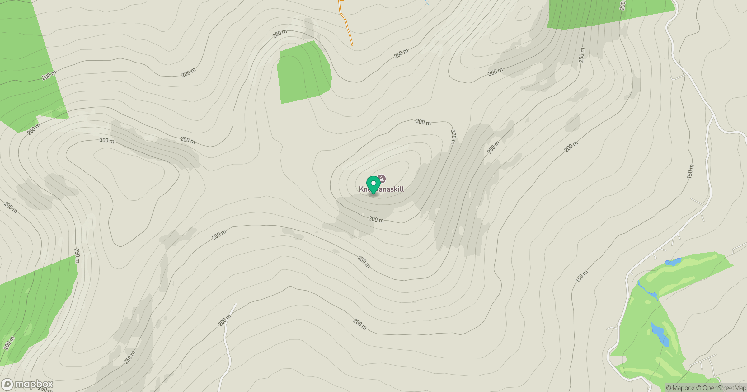
Grid reference: V834717
View on OpenStreetMapOpens a map in a new tab, centred on the hill.
Hills within 30 km
Straight-line distance, not a walking route or confirmation of access.
No comments yet. Be the first.